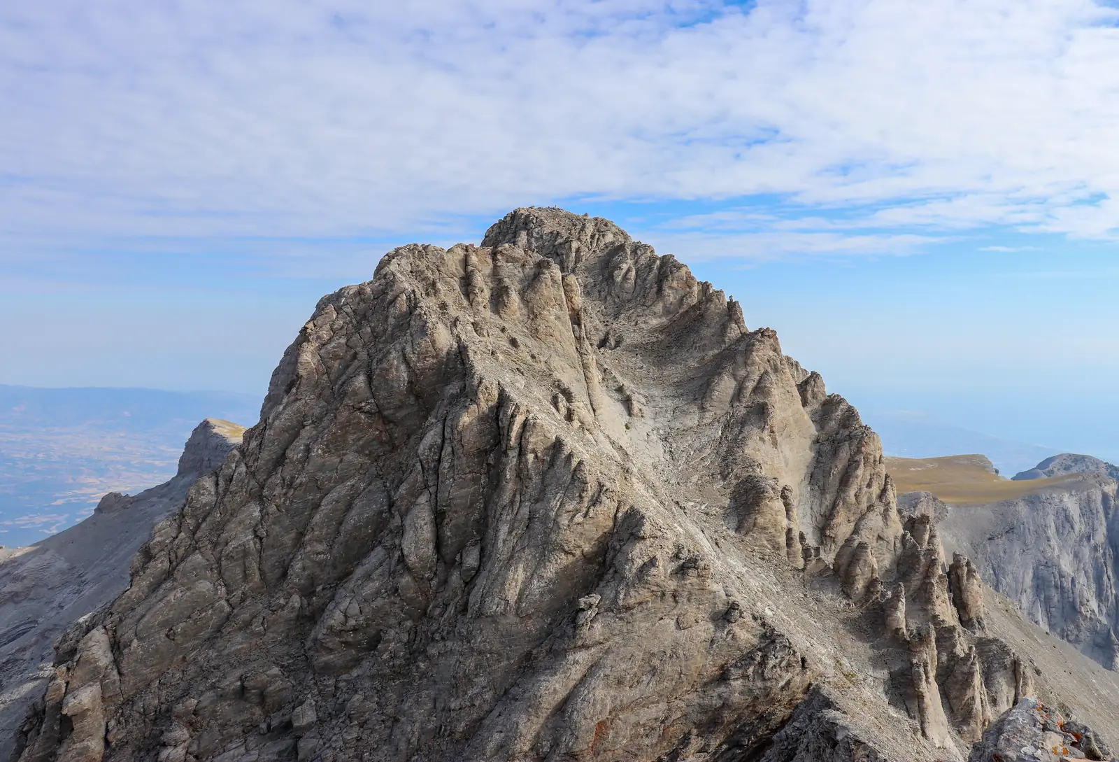
Olympus, 2,918 m
Sheet 01 of 11Walked 2026
- Range:
- Olympus massif
- Coordinates:
- 40.0856° N, 22.3586° E
Mytikas from Skala, the neighbouring summit, in September 2019. The white line is the recorded track.
The climb, to scale
-
Mytikas
-
High point
-
Kakkalos
-
Spilios Agapitos
-
Petrostrouga
-
Gortsia
-
Prionia
-
Agios Dionysios
The record
Three days across the massif: up the Enipeas gorge, along the Zonaria path under Mytikas, and down the north side. Two refuge nights, a full track and a heart-rate record.
- The route’s grade
- Mountain hike
- Distance
- 36.8 km
- 18–20 September 2026
- Ascent
- +2,237 m
- Highest point 2,728 m
- Moving
- 15:24 h
- 56 h 22 min in all
- Heart rate
- 103–123 bpm
- Daily averages
Why it is in the plan
From the roadmap: 2026, first mountain.
- First multi-day mountain experience.
- Learn basic pacing and endurance.
- Understand how the body responds to long ascent days.
- Begin building mountain judgment and confidence.
What it adds
- Technical ability
- Altitude experience
- Expedition experience
- Endurance
- Mountain judgment
- Risk management
Three days
Distance and ascent from the track. Heart rate, calories and effort from the watch, where effort is Apple’s 1–10 scale.
-
Day 1
Fri 18 Sep, 12:12–19:22
Enipeas gorge to Refuge A
Agios Dionysios, 850 m to Spilios Agapitos, 2,060 m
- Distance
- 15.0km
- Ascent
- +1,327m
- Descent
- −118m
- Moving
- 5:59h
- Heart rate
- 119bpm
- Energy
- 2,012kcal
Effort 5/10
The longest climb of the trip, on good trail the whole way.
-
Day 2
Sat 19 Sep, 11:00–15:48
Zonaria to the Plateau of the Muses
Spilios Agapitos, 2,060 m to Kakkalos refuge, 2,640 m
- Distance
- 7.2km
- Ascent
- +733m
- Descent
- −108m
- Moving
- 4:42h
- Heart rate
- 123bpm
- Energy
- 1,086kcal
Effort 6/10
Highest point of the trip at 2,728 m. Cloud and 12 °C on the traverse.
-
Day 3
Sun 20 Sep, 12:52–20:34
Down the north side to Gortsia
Kakkalos refuge, 2,640 m to Gortsia, 1,110 m
- Distance
- 14.5km
- Ascent
- +208m
- Descent
- −1,638m
- Moving
- 6:11h
- Heart rate
- 106bpm
- Energy
- 1,338kcal
Effort 4/10
1,600 m of descent, recorded as two walks with a long stop between.
What the numbers say
This trip is the baseline. Every other mountain on the site is measured against it.
- Endurance
The 1,327 m day took six hours of walking at an average of 119 bpm, an effort of 5 out of 10. That is a steady, conversational pace with a pack, held all day.
- Recovery
Three days back to back, and the third, all descent, ran at 106 bpm. Legs and knees are not the limit yet.
- Altitude
Highest point 2,728 m. Every other peak on the roadmap finishes at least 1,300 m higher, so altitude is the first real unknown.
- Technique
No hands on rock, no snow. Mytikas is a Class III scramble and stays for a later visit; the Alps need a snow course first.
Map data © OpenStreetMap contributors, SRTM. Contours © OpenTopoMap, CC BY-SA. Aerial © Esri.