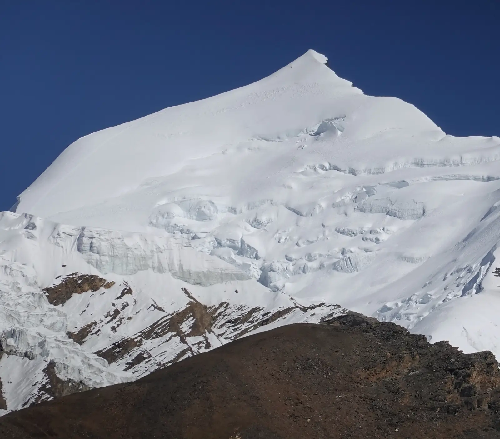
Himlung Himal, 7,126 m
Sheet 09 of 11Stage 2029
- Range:
- Peri Himal
- Coordinates:
- 28.7719° N, 84.4221° E
Camp 3Below the col, 6,350 mCamp 2Glacier plateau, 6,050 mCamp 1Ridge above the glacier, 5,450 mBase campNight, 4,850 mHimlung Himal7126
024km
The summit pyramid and icefall from base camp, in November. The dotted line is the normal route, schematic; camps move from year to year and are placed approximately.
The climb, to scale
-
Himlung Himal
-
Camp 3
-
Camp 2
-
Camp 1
-
Base camp
How hard
- The route’s grade
- Glacier, fixed ropes
- For me
- Expedition
- Mountain days
- 15–17
- Inside a 31–34 day expedition
- Biggest day
- +780 m
- 8–10 h up, 4–5 h down
- Season
- Oct–Nov
- Endurance
- Altitude
- Technical
- Exposure
After Mera Peak and the Alps the climbing is within reach: PD with fixed ropes. The unknown is a week of rotations above 6,000 m and a ten-hour summit day to 7,126 m. Easier after Mera Peak or Lobuche East.
- High-altitude boots
- Crampons
- Ice axe
- Harness & rope
- Ascender
- Helmet
- Tent
Why it is in the plan
From the roadmap: 2029, first 7,000 m. Milestone: Prove readiness for an 8,000 m expedition.
- First 7,000 m summit attempt.
- High-altitude expedition experience.
- Multiple high camps.
- Extended exposure above 6,000 m.
- Test recovery, sleep, appetite and decision-making at extreme altitude.
- Learn expedition logistics and camp routines.
What it adds
- Technical ability
- Altitude experience
- Expedition experience
- Endurance
- Mountain judgment
- Risk management
Map data © OpenStreetMap contributors, SRTM. Contours © OpenTopoMap, CC BY-SA. Aerial © Esri.